
Mid-Missouri continues to face the potential for heavy rain that may cause additional flooding.
The National Weather Service continues a Flash Flood Watch in effect until Tuesday evening for an area that includes Boone, Callaway, Cole and Moniteau counties. In addition, a Flood Warning remains in effect for the Missouri River at Jefferson City until late Saturday morning, at Chamois until Sunday evening, at Hermann until Sunday afternoon, as well as the Osage River near the Mari-Osa Campground until Saturday evening.
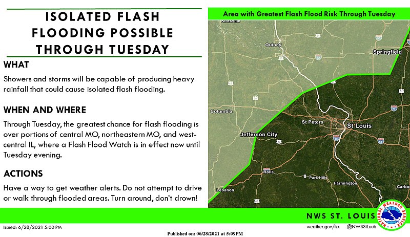
Waves of showers and thunderstorms capable of heavy rainfall are expected at times Tuesday across northeast and central Missouri. This heavy rainfall could occur repeatedly over some locations, including those that have previously received significant rainfall, leading to localized flash flooding.
Excessive runoff may result in flooding of rivers, creeks, streams, and other low-lying and flood-prone locations. Area creeks and streams are running high and could flood with more heavy rain. Rainfall heavier than forecast could cause river levels to rise even higher than predicted.
More information:
Weather forecast, radar, warnings and advisories at https://www.weather.gov/lsx/
Eastern Missouri river stages at https://water.weather.gov/ahps2/index.php?wfo=LSX
Western Missouri river stages at https://water.weather.gov/ahps2/index.php?wfo=eax
Missouri Traveler Information Map at https://traveler.modot.org/map/index.html
Ameren's Truman and Bagnell Dam daily report at https://apps.ameren.com/HydroElectric/Reports/Osage/HSTBagnellDaily.aspx
National Weather Service updates for Missouri on Twitter at https://twitter.com/i/lists/1131249702131781632