
Friday started several days of prolonged rainfall expected in Central Missouri. If forecasts hold up, local officials foresee potential flooding on the Missouri River in Jefferson City.
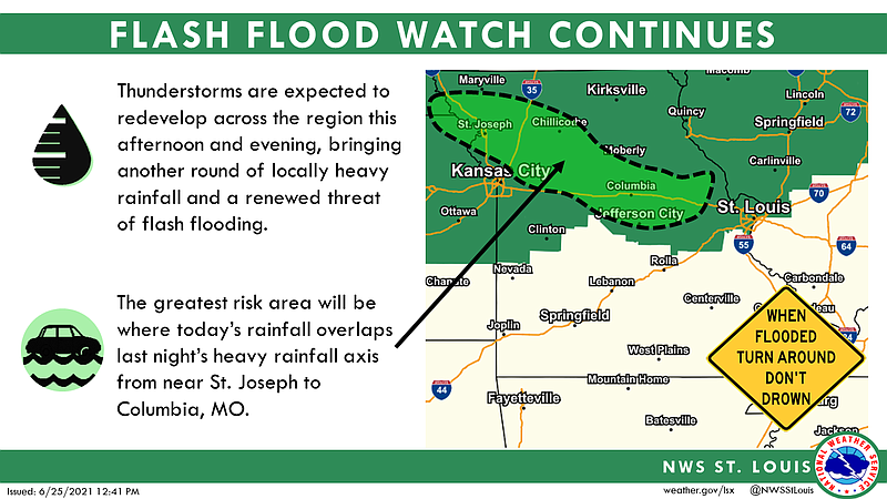
Heavy rainfall in the 6- to 10-inch range fell over a large portion of northern Missouri on Thursday night and Friday morning, according to the U.S. Army Corps of Engineers. As a result, flash flooding occurred along tributaries in the lower Missouri River basin.
The Corps also had reports of some levees being overtopped and breached.
As of Friday afternoon, observations from the National Weather Service in St. Louis showed the Missouri River in Jefferson City was over 16 feet, but due to the heavy rain at locations along the river to the north, the river is predicted to rise rapidly.
The Missouri River was forecast to rise above flood stage of 23 feet by late Friday night, reaching 28 feet by Saturday afternoon and as high as 30.2 feet by Monday afternoon. That mark would fall just below ranking in the top 10 of highest crests.
With more significant rainfall likely over the next several days, the NWS predicts it will take the river several days to dip below flood stage, probably by late next week - just before Jefferson City's Salute to America celebrations are planned.
Jefferson City Public Works Director Matt Morasch said staff has been making preparations such as getting barricades ready in case of flooding.
Morasch noted this will be the first test of the Capital View Levee since it was breached in flooding during 2019.
The levee repairs were complete last September, after repair work started in mid-May 2020 to include placement of approximately 43,400 cubic yards of fill in seven breaches at six locations along with erosion repairs and seeding/ mulching. The levee was built back in its same location, which stretches throughout North Jefferson City, and to its previous height of 30 feet.
Public works crews try to keep the city's many culverts clean, Morasch said, but that can be difficult because debris tends to build up any time there is significant rain. He said the city will have on-call staff monitoring conditions.
NWS Meteorologist Jayson Gosselin said the stretch of rainy weather comes courtesy of a stalled front that forecasters don't believe will waiver much over the next few days.
"One bit of good news: Any downpours we see over the next few days should be more scattered and not as heavy as the rains seen Thursday night and Friday morning," Gosselin said. "The ground is saturated because of those heavy rains that it wouldn't take much additional rain to lead to flash flooding."
The NWS had reports of 3-6 inches of rainfall in Central Missouri, with the heaviest amount - 6.7 inches - reported in Lupus in Moniteau County, Gosselin said.
"Prior to this, we were abnormally dry with 15-20 straight days of hot weather," Gosselin said. "We were going into drought conditions pretty quickly, but this turned that around. It was just too much too soon."