
Extreme erosion along the lower Osage River has produced a multitude of issues for the waterway and environment around it. River conditions are diminishing endangered aquatic species, carving down private land banks and destabilizing the river bed.
State and federal agencies are taking notice.
The Missouri Department of Natural Resources is partnering with the U.S. Army Corps of Engineers on two multi-year projects to address the severe erosion and restore aquatic ecosystems of multiple endangered species.
The efforts include an 80-mile investigative river study and a feasibility study of a river site near Brockman Springs Road in Miller County.
By addressing bank erosion and sedimentation along the lower Osage River, DNR and the Corps hope to restore degraded aquatic and riparian habitats, promote fish and wildlife biodiversity and reduce negative impacts of erosion on nearby land and infrastructure.
Jeffry Tripe, environmental program project manager with the Kansas City District of the U.S. Army Corps of Engineers, said the site-specific study, which he referred to as the Continuing Authorities Program Section 1135 project, will be done in three phases, beginning with a feasibility study.
The study will assess issues along the river near Brockman Springs Road, develop restoration measures to address those issues and produce a recommended plan with alternatives that provide the most value to ecosystems relative to costs to implement.
After the feasibility study is approved, the project will move to a design phase to further develop details and specifications for implementing the recommended plan, Tripe said.
From there, the recommended plan would be implemented through a construction contract and the Army Corps of Engineers would turn the site back to DNR to operate and maintain.
In addition to the Section 1135 project at Brockman Springs Road, the Army Corps of Engineers and DNR are partnering on an investigation study over the next few years to address systemic ecosystem issues throughout the lower Osage River.
At approximately 82 miles, the lower Osage River snakes through Mid-Missouri from the Bagnell Dam at Lake Ozark to the confluence with the Missouri River near Bonnots Mill.
Several ecosystem problems have been identified within that stretch of river, Tripe said, and many stem from eroding banks.
"There's a severe erosion problem," said Tim Rielly, a biologist with the Missouri Department of Natural Resources.
Rielly said local landowners have raised concerns about losing stream banks because of erosion, which also affects the lower Osage River as they feed into it.
He said understanding how the Osage River is degrading the land around it is a priority for the state agency and landowners.
In addition to severe streambank erosion, Tripe said, the lower Osage River is experiencing downstream channel widening, riverbed instability and barriers to the migration of aquatic species. The river also presents increased risks to surrounding infrastructure and life safety hazards, he said.
Tripe said channel and stream bank degradation is reducing the quantity and quality of riparian and aquatic habitats in the lower Osage River, and the continued loss of aquatic habitats negatively affects several threatened and endangered mussels and fish species.
The lower Osage River is home to four species the U.S. Fish and Wildlife Service considers to be threatened or endangered: pink mucket clams, scaleshell mussel clams, spectaclecase mussel clams and pallid sturgeon fish.
Erosion of stream banks and changes in the river channel destroy habitats and reduce fish spawning and mussel reproduction, Rielly said.
Tripe said the lower Osage River's problems are a result of upstream reservoirs altering hydrology and water movement, variable flows as a result of hydropower generation from the Bagnell Dam and Osage Power Plant, legacy instream structures and obstructions to side channels.
Those factors contribute to the river widening, Rielly said, and part of the study's analysis will determine how much it is expanding where the most erosion has occurred.
Tripe said site and helicopter surveys, reviews of historical mapping, LiDAR, hydrology and hydraulic modeling and bathymetry (the study of water depth) have been used to confirm degradation of the lower Osage River.
The information obtained from those measures will be used to document existing conditions of the river, Tripe said, and to project what the river will look like in the future if issues aren't addressed.
The $3 million study, split 50/50 between the DNR and the Corps, will take approximately three years and at least a dozen personnel, Rielly said, including engineers, hydrologists and biologists.
After the study, the U.S. Army Corps of Engineers has to approve construction design plans to make it eligible for congressional funding, which would cover 65 percent of construction costs.
Tripe said the first step of the lower Osage River feasibility study is to identify and assess restoration measures that could potentially be implemented.
To address erosion, Tripe said, the agencies are considering, among other measures, bank sloping and bench cuts with plantings, planting alone, hard structures like riprap (a layer of rock to armor bank soil), notching legacy structures, dredging (removing silt and material from the bottom of the river) and features to support the natural flow of the river.
Measures the agencies may take to support threatened and endangered species in the river include stabilizing existing mussel beds and habitats, improving the flow of side channels and bolstering connectivity by addressing erosion and aquatic barriers, Tripe said.
Tripe said the potential recommended plan resulting from the feasibility study can include any combination of those site-specific measures.
"During the feasibility phase, conceptual cost estimates will be developed for viable alternatives to identify the most complete, efficient, effective and publicly acceptable plan for implementation," he said.
Reducing erosion and limiting the buildup of sediment in the lower Osage River should deepen main and side channel depths over time and increase in-stream habitat depths and diversity, Tripe said, "which will benefit native aquatic species to include the pallid sturgeon."
The three endangered mussel species will also directly benefit from the reduction in sedimentation, he said, because better water quality reduces the likelihood mussel beds become covered in sediment and provides new areas for mussels to inhabit.
By stabilizing stream banks, Rielly said, the project should positively impact local landowners who are losing land to erosion and the river ecosystem that has been negatively impacted by the increase in sediment.
"There will be dual benefits," he said.
Rielly said the lower Osage River was selected for restoration because of habitat degradation and interest among landowners, DNR and elected officials, including Republican Congressman Blaine Luetkemeyer.
"Thousands of Missourians live along the banks of our state's rivers, streams and lakes. I am committed to continuing my work on many important issues facing our water resources, including channel and stream bank degradation, flood protection, navigation, and property rights," Luetkemeyer's website states. "We need to focus on protecting human life and property and maintaining the safety and soundness of our levees."
Luetkemeyer, who represents Missouri's 3rd District, is actively engaged with the federal Water Resources Development Act of 2022.
The legislation, which was approved by a congressional committee, is aimed at furthering the Water Resources Development Act of 2020 that authorized 27 feasibility studies of water resource projects around the country. The 2022 version of the bill would authorize 72 new feasibility studies for water projects and direct the Army Corps of Engineers to expedite the completion of 14 feasibility studies already under way.
Additionally, the restoration efforts are supported by cooperating agencies such as the U.S. Fish and Wildlife Service, Missouri Department of Conservation, Ameren, the Natural Resources Conservation Service and the Environmental Protection Agency, Tripe said.
"If the proposed restoration is not conducted, the future without project conditions in the lower Osage will continue to degrade, resulting in continued erosion, decreased connectivity of in-stream and riparian corridor habitat, continued aggradation in the main and side channels, and decreased population numbers of native and endangered species," Tripe said.
That continued degradation would also mean more loss of private land for landowners, the river water quality remains poor, risks to infrastructure persist and there's an increased potential for life safety hazards, Tripe continued, which would also mean fewer recreational opportunities on the river.
"These are typically big problems that cost a lot of money to solve or mitigate," Rielly said. "So it's a study that yields solutions, not just a study to study -- which is not a bad thing either."
 Julie Smith/News Tribune photo: The roots of two large sycamore trees on the river bank were exposed and the property owner filled around those and covered the soil with the rip rap material.
 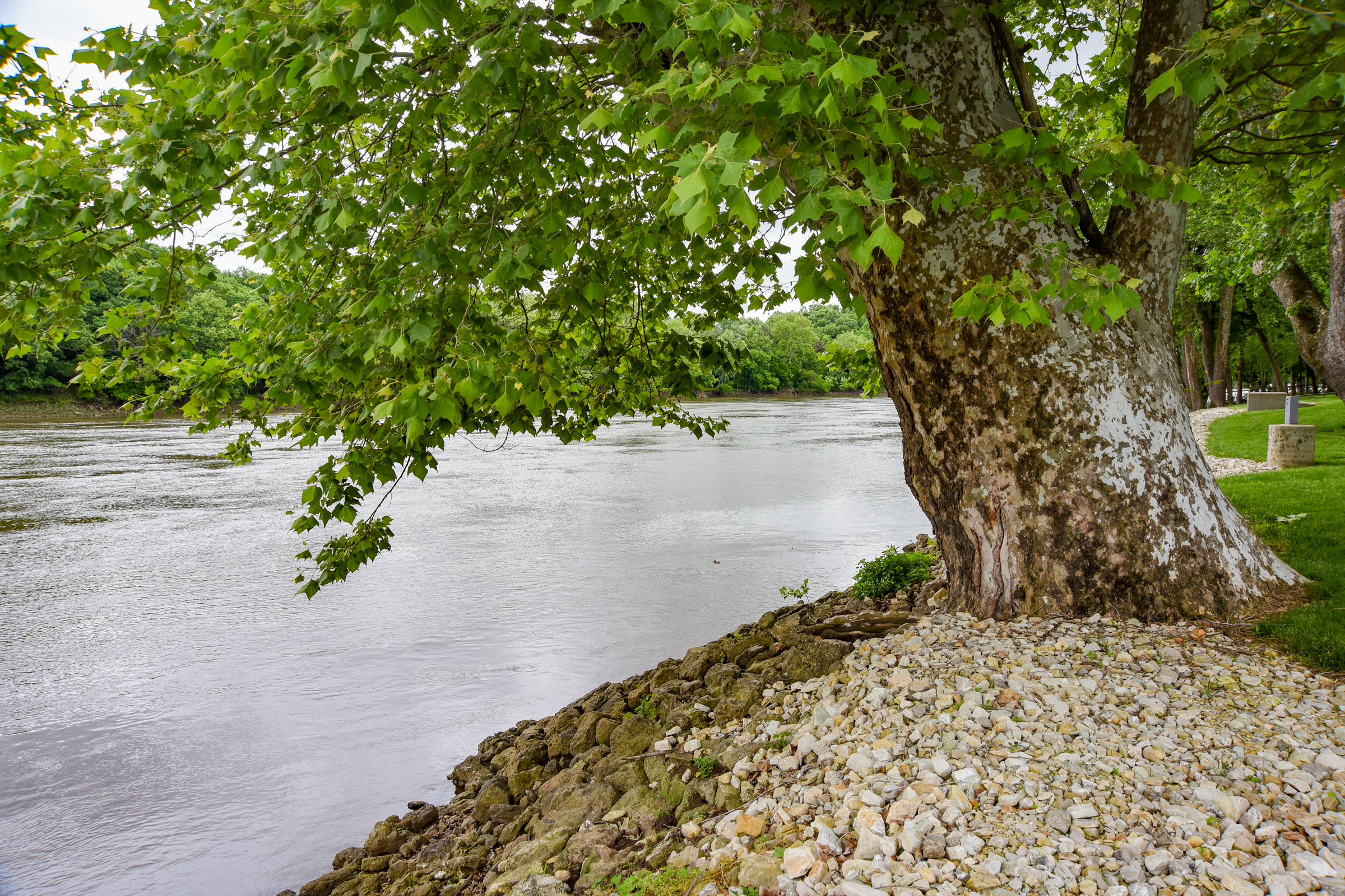 Julie Smith/News Tribune photo: The roots of two large sycamore trees on the river bank were exposed and the property owner filled around those and covered the soil with the rip rap material.
 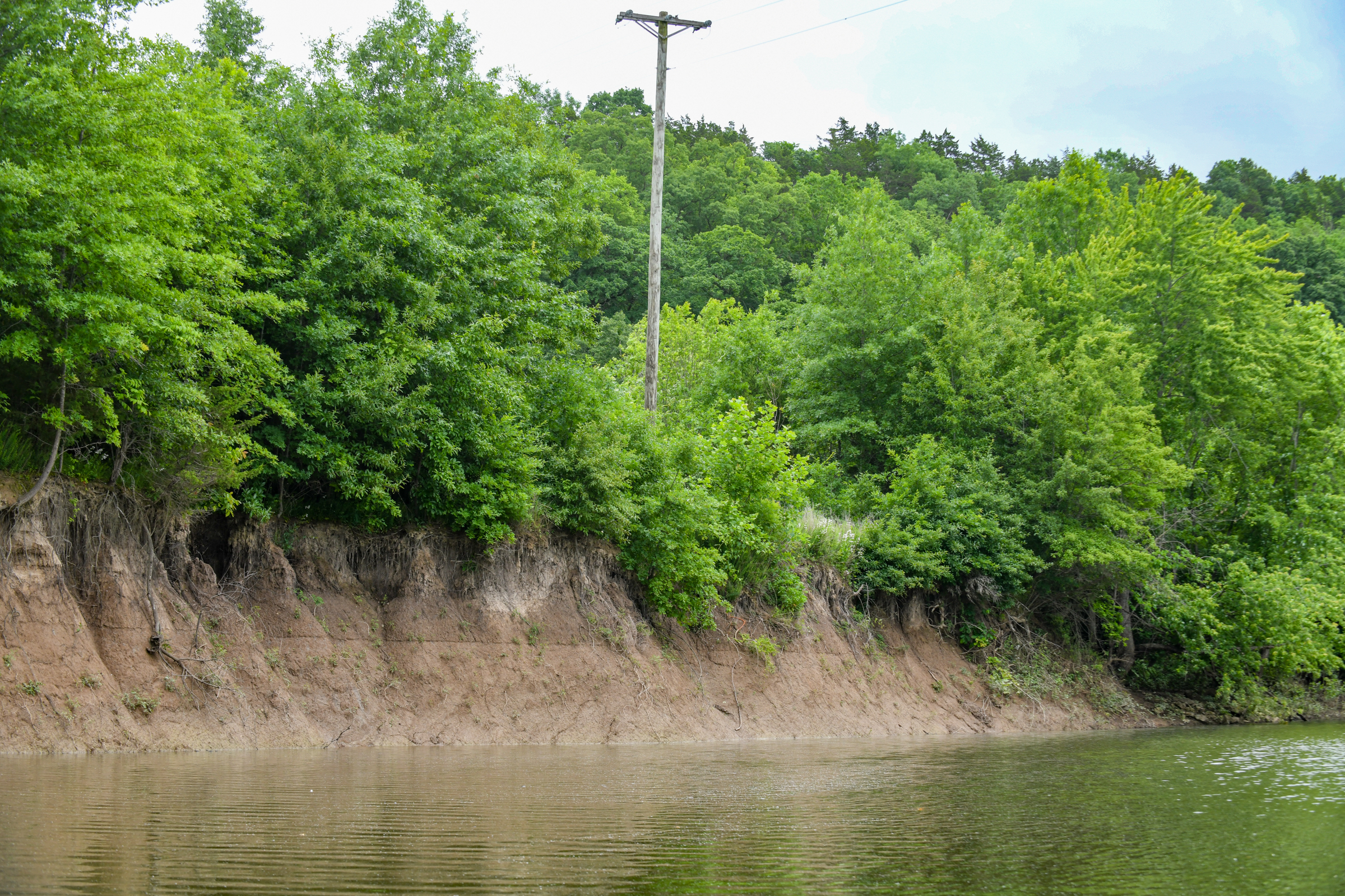 Julie Smith/News Tribune photo: Although this particular inlet is on the Maries River, which feeds into the Osage River, the issue of erosion on the banks is the same.
 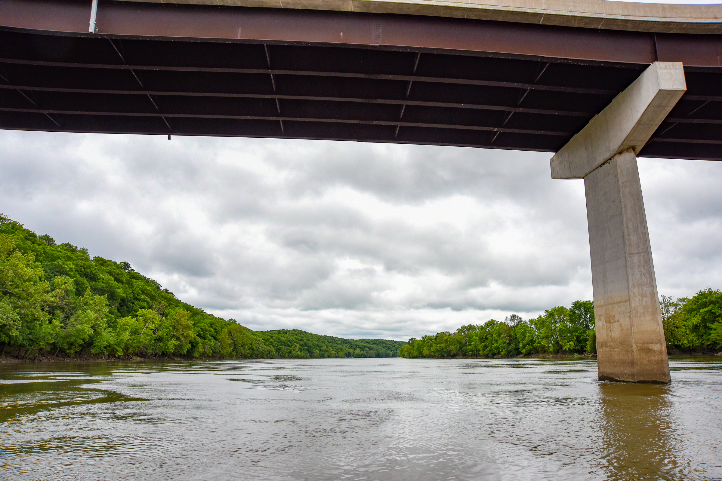 Julie Smith/News Tribune photo: Both U.S. 50/63 bridges over the Osage River are seen here where the current water level is running high due to the amount of water being released from Bagnell Dam.
 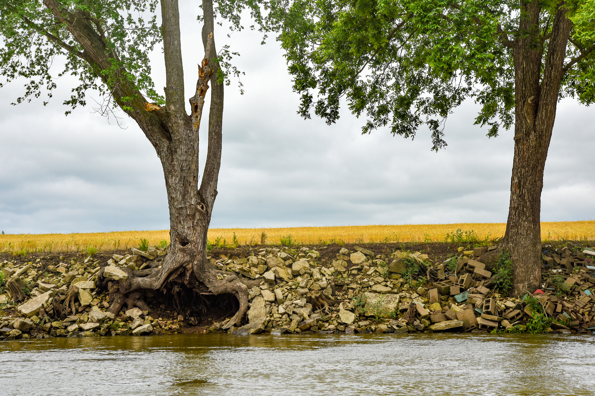 Julie Smith/News Tribune photo: Over the years, landowners along the banks of the Osage River have used various materials to serve as a rip rap to hold the soil in place to prevent erosion.
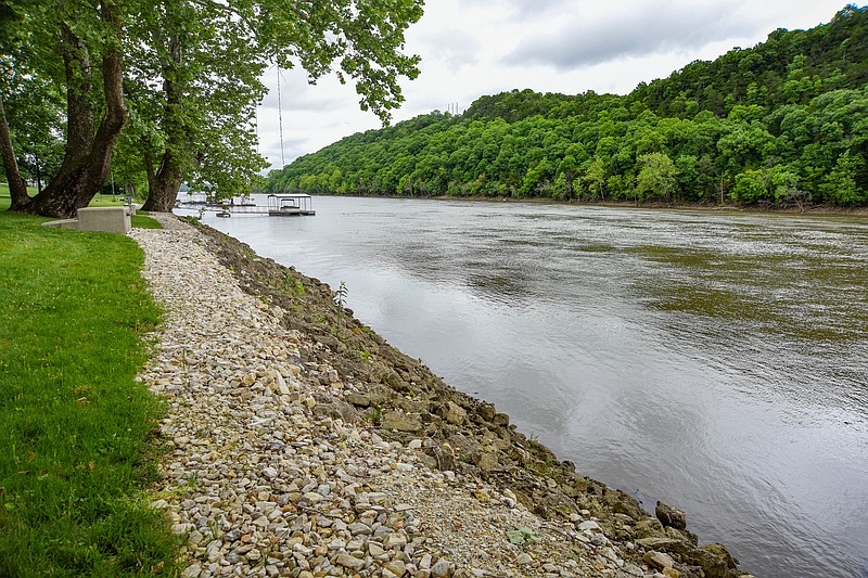
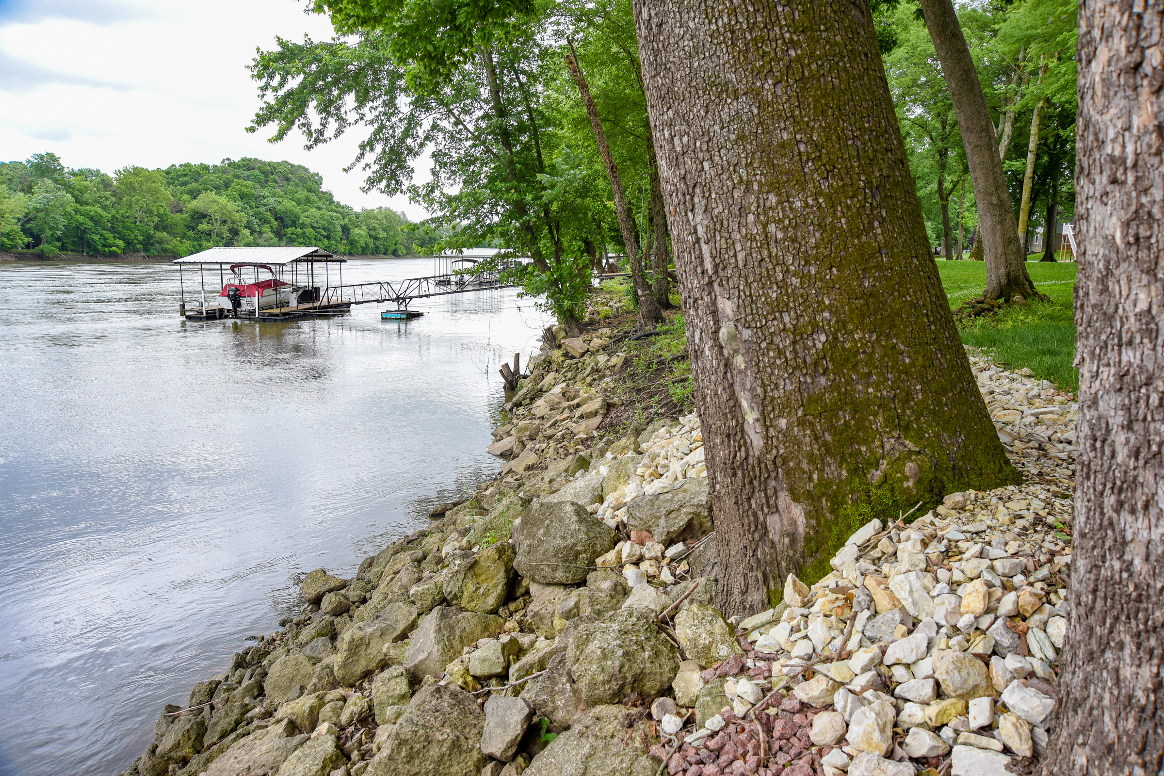
  Julie Smith/News Tribune photo: Over the years, landowners along the banks of the Osage River have used various materials to serve as a rip rap to hold the soil in place to prevent erosion.