
Update posted at 5:26 p.m. Tuesday
HAMBURG, Iowa (AP) - Dozens of workers raced Tuesday to add several feet to a levee that now stands as the lone barrier between Hamburg and the floodwaters of the Missouri River that threaten to fill the small town like a bathtub.
Crews working for the Army Corps of Engineers hoped to pile at least three feet of extra dirt atop the temporary levee. But time was short and the stakes were high: If the levee were to fail, parts of this southwestern Iowa community could be covered by as much as 10 feet of water within days. And the high water could linger for months.
The construction work stirred up a cloud of dust as teams hurried to complete the improvements by Wednesday evening. The earthen levee became Hamburg's last line of defense after the river punched through another levee downstream in northwest Missouri that provided the town's primary protection.
That failure left water gushing through a large gap on a path to inundate the town of 1,100 - unless the other levee can be made taller.
"I feel good about it," Fire Chief Dan Sturm said. "But we can't guarantee anything. We've never really had to cope with anything of this magnitude."
Even though the levee breach was downstream, the floodwaters are flowing north to fill the area around Hamburg because the town sits in a valley. The fire chief compared the geography to a slowly filling bathtub.
The floodwaters were initially expected to reach Hamburg on Tuesday, but the corps later said the workers would have an extra day to finish the job because the water won't reach the new levee until sometime Wednesday.
The river has been rising steadily for weeks as the corps increases the amount of water released from its dams to clear out heavy spring rain and snowmelt.
On Tuesday, the releases at Gavins Point Dam in South Dakota hit the maximum planned amount of 150,000 cubic feet of water per second. So officials downstream in Nebraska, Iowa and Missouri were sure to be watching for more levee problems.
The dam releases are expected to raise the Missouri River 5 to 7 feet above flood stage in most of Nebraska and Iowa. In Missouri, the river may climb 10 feet above flood stage in some places and spill over the top of several rural levees.
Parts of Montana, North Dakota and South Dakota have already seen some flooding, and officials predict the problems will linger through the summer because of the large volume of water already in the river and the larger-than-usual Rocky Mountain snowpack.
The corps does not expect to reduce the amount of water released from the dams until at least August.
So far, the floodwaters have covered mostly corn and soybean fields with few structures. But it's an unwelcome development for the farmers because grain supplies are at historically low levels and demand is strong for every bushel of corn and soybeans.
Still, the loss of the crops is unlikely to mean much to overall U.S. production because the areas underwater are relatively small.
Mike Nenneman, a farmer from Sidney, is waiting for the flood to swamp a 360-acre tract of corn and soybeans he owns in far southwest Iowa. He expects to break even, with $700 per acre in crop insurance to offset his losses.
"We are the drain of southwest Iowa," Nenneman said, gesturing to the Missouri River to the west and the Nishnabotna River to the east. "We take all the water from everywhere."
In Hamburg, workers hoped to complete the levee project by Wednesday night. When finished, it will be about eight feet tall in most places.
A line of tractor-trailers carrying dirt to the levee stretched for more than a quarter-mile Tuesday morning. Once the trucks reached the work area, tractors and other earth-moving equipment carried and pushed it to the levee.
To help buy some additional time for the levee work, the corps approved a plan to cut a 300-foot-wide, three-foot-deep notch in the same Missouri River levee south of Hamburg that recently failed.
The notch will allow some of the floodwater to drain back into the river, but will only slow the water's advance toward Hamburg, said Col. Bob Ruch, commander of the corps' Omaha district.
The corps started building the new Hamburg levee last week after finding problems in the main levee in Missouri.
Several businesses near the levee stood empty Tuesday as crews toiled on the new levee.
Todd Morgan with A&M Green Power Group says the owners of the John Deere dealership moved their business to one of the company's other dealerships in Shenandoah, 25 miles away.
"We wanted to play it safe than sorry," Morgan said. "Every day that goes by, you seem to hear something different. With the breach yesterday, we just don't know what the integrity of that levee is."
Morgan said he doesn't know whether the dealership will return.
Fremont County Sheriff Kevin Aistrope said all but seven of the roughly 40 households in the southern part of Hamburg have evacuated voluntarily. The remaining seven have moved all of their furniture and can escape quickly if water floods the town, he said.
Aistrope said the department has summoned 20 part-time reserve deputies, in addition to the regular eight-member staff, to help with law enforcement and traffic issues.
About 45 miles south of Hamburg in Missouri, the river also broke through a levee near Big Lake in Holt County. About 30 residents who had stayed in the resort town after the river started rising were told to leave Monday, but some refused to go.
Funk reported from Omaha, Neb. Associated Press videographer Robert Ray in Hamburg, Iowa, and AP writers Maria Fisher in Kansas City, Mo., and Michael Crumb and Melanie Welte in Des Moines, Iowa, contributed to the story.
Online:
National Weather Service river forecast
U.S. Army Corps of Engineers Omaha District
U.S. Army Corps of Engineers Kansas City District
Earlier coverage posted at 5:48 a.m. Tuesday
HAMBURG, Iowa (AP) - Crews are trying to beat floodwaters expected to arrive in Hamburg on Tuesday by building up a secondary barrier to protect the small Iowa town after the swollen Missouri River punched a massive hole in the main levee.
The river ruptured two levees in northwest Missouri on Monday, sending torrents of water over rural farmland toward Hamburg in southwest Iowa and a Missouri resort community downriver. By Wednesday, water spilling through a nearly 300-foot hole in the levee near Hamburg was expected to top a secondary levee built last week to protect the town.
The Army Corps of Engineers said crews are working to increase that wall's height by 3 feet. If it breaks, parts of Hamburg could be under as much as 10 feet of standing water, officials said.
"For right now, we believe we'll be able to get that elevation raised in the time available as that water flows across in the next 48 hours," Col. Bob Ruch, the corps' Omaha District commander, said Monday evening. "We've had excellent working conditions."
Across the border in Missouri, the river broke a 225-foot-wide hole through a levee near Big Lake in Holt County. About 30 residents had stayed in the resort town after the river started rising, but they were told to leave Monday. Big Lake is about 45 miles south of Hamburg.
The Army Corps of Engineers has steadily increased the amount of water it is releasing from dams along the Missouri River to account for excess water from heavy spring rains in the northern Plains and to clear out space for above-average snowmelt coming down from the Rocky Mountains.
Releases from the river's five lower dams should reach 150,000 cubic feet of water per second Tuesday - more than twice the previous record releases.
Areas in Montana, North Dakota and South Dakota, have already seen some flooding, and officials predict the problems will linger through the summer.
National Weather Service hydrologist Dave Pearson described the breach near Hamburg as "pretty substantial." He said water was "flowing through quickly" but still must cross several miles of rural land to reach the Hamburg area.
It wasn't clear how deep the floodwaters approaching Hamburg were or whether they would prove too much for the secondary levee. Local officials posted video of the breach that showed the water spreading over a large area of farmland.
Terry Holliman, who owns an auto parts store in the town of about 1,100 residents, said water was shooting into farmland near one of three spots where the levee had previously leaked.
"It's impressive," Holliman said early Monday. "The force is unbelievable."
About 300 Hamburg residents left their homes and businesses last week under an evacuation order after partial breaches in the main levee, which is about 5 miles south in rural Atchison County, Mo.
The Army Corps of Engineers has been building up the secondary levee to protect low-lying areas of Hamburg since the partial breaches. Officials had been able to stabilize the initial leaks but had predicted the main levee eventually would fail.
Corps projections show that if the secondary levee fails, the volume of water released upstream during a levee break could leave 8 to 10 feet of standing water in southern Hamburg. The area includes manufacturing and agricultural businesses. Water could reach the fire station and City Hall, but it likely wouldn't reach the northern part of town where most residents live.
Longtime resident Pat Stoop was among those in flood-threatened neighborhoods who were hauling the last of their belongings out of their nearly empty houses Monday. The last time her home flooded, in 1993, the water barely crept over the floor, but it stayed for weeks. When she returned, her ceiling fan was covered in 3 inches of mold.
She's now considering a permanent move from the home where she's lived for more than four decades. Stoop said she was "thinking about 40 different things at once ... You start to do something, and then another thing, and before you know it you have 40 balls in the air. And you keep dropping them."
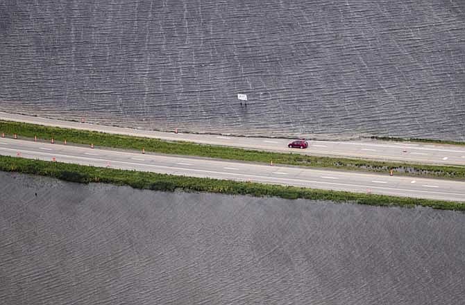
Iowa officials said they would close more than 20 miles of Interstate 29 in southwest Iowa and northwest Missouri by Thursday. Northbound lanes near Hamburg will be lined with about 7,500 feet of flood barriers, Ruch said.
In Missouri, Holt County officials said the second levee breach occurred about 5 miles northwest of Big Lake. Most of the town's roughly 150 residents left before Monday and Big Lake State Park was already closed.
The breach was pushing water into agricultural land, though a private levee that farmers built last year is helping slow the advancing flood, Holt County Clerk Kathy Kunkel said. Officials expect the private levee to eventually fail because of the large amount of water.
The record dam releases are expected to bring the Missouri River 5 to 7 feet above flood stage in most of Nebraska and Iowa before continuing into Missouri, where it may rise 10 feet above flood stage in several places and flow over the top of at least 11 rural levees. This summer's Missouri River flooding could rival the record years of 1952 and 1993 in some places.
The river is expected to remain high at least into August as the record releases from the dams continue.