
Winter weather that moved through Mid-Missouri on Wednesday hit at one of the worst possible times.
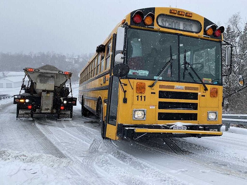
Snowfall that began around 6 a.m. affected the morning rush hour, leading to numerous crashes on U.S. 63 between Jefferson City and Ashland.
Other areas affected included eastbound U.S. 54 at Missouri 179, which was closed for a time due to a crash and that stalled traffic. In Osage County, Missouri 133 near Westphalia was closed with a jackknifed tractor-trailer blocking both lanes of the road.
Jefferson City police worked an accident at the intersection of Southwest Boulevard and Woodclift Drive, where a vehicle knocked down utility lines. A JeffTran bus and a vehicle collided in the 500 block of East Dunklin Street.
On U.S. 63, south of the Boone/Callaway County line, Missouri Highway Patrol troopers reported a vehicle slid into a Holts Summit Fire Department truck.
Authorities reported those involved in most of the accidents had minor or no injuries.
Some area schools, like the Cole County R-5 School District in Eugene, canceled classes, while others, including the Jefferson City School District and parochial schools in Jefferson City, remained in session.
State and local road department officials said they had done some pre-treatment of roadways before the storm.
"We did a little bit, but nothing of a great magnitude," said Missouri Department of Transportation Central District Maintenance Engineer Jason Shafer. "The big problem was the time the storm hit was bad. This was also the first significant snowstorm we have had in this area in a while.
Jefferson City Operations Division Director Britt Smith said supervisors were monitoring road conditions at 3 a.m. and were able to get crews out just as the storm started, but they didn't pre-treat roads overnight because they weren't sure it would be necessary.
"The snowfall ranges changed overnight, and this ended up being a strange storm," Smith said. "The snow didn't look that heavy, but it fell fast enough that it covered up salt we had put down, so that wasn't activating like it should. Hitting right at the start of the morning drive just added to the problems."
Cole County Road Superintendent Bryan Boyce said county crews started working at 5 a.m. and they didn't expect heavy snow to hit until around 6 a.m.
"I believe we had 90 percent of our roads treated before the storm hit," Boyce said. "This was just a perfect storm because the road temperatures fell fast and the snow stuck as soon as it fell."
The priority for which state roads are cleared first hasn't changed for MoDOT, Shafer said.
"We till treat major roads first and work our way down," Shafer said. "Here in the Central District, that would mean I-70 would be a top priority and then other multi-lane roads like U.S. 50, 63 and 54. We want to get to the roads with more traffic to help the most people in the shortest amount of time."
In Jefferson City crews concentrate first on main routes such as McCarty Street, High Street, Clark Avenue and West Truman Boulevard, Smith said.
"We're not ignoring secondary streets, but if we can keep the main routes in good shape, then we can move onto the secondary streets and subdivision streets," Smith said.
In Cole County, paved roads get priority, Boyce said.
"We do put the plows and spreaders out on the paved roads first, but we will not leave or quit until all paved and gravel roads have been completed after a storm hits," Boyce said.
Shafer said smaller storms can be more difficult to deal with than heavier snow.
"All storms are unique and have their own different challenges," Shafer said. "In this case, had it hit a few hours earlier, the roads may have looked different when drivers hit the road."
The snow ended in Jefferson City by mid-day. The National Weather Service in St. Louis had reports of 1.8 inches in Ashland and 2 inches in Jefferson City and Lake Mykee.
"Tuesday night we forecasted 1-3 inches, and this was one of the larger storms we've seen because we've had quite a snow drought," said NWS meteorologist Melissa Mainhart.
According to records at the Columbia Regional Airport, which is the official weather station for the NWS in Central Missouri, before Wednesday's snowfall this area was on track to have its 10th-driest winter in terms of snowfall with only 3.6 inches recorded, Mainhart said. A normal January in Central Missouri would have a total of 5.3 inches of snow.
"If we had more cold air in place, we would have had more snow; but instead it's been warm enough that we've had more rain than snow so far this winter," Mainhart said.
Temperatures are expected be back above freezing Thursday, with a high temperature near 50 degrees Friday before rain moves in Saturday, Mainhart said.