
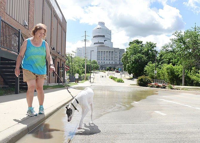
By midday Thursday, the Missouri River had reached 32.5 feet in Jefferson City, almost 10 feet above flood stage of 23 feet.
Mostly dry conditions were forecast through the weekend, and the National Weather Service in St. Louis predicted the Missouri River would dip about a half-a-foot before rising to 32.8 feet sometime Monday.
"This is still usually a more active time for stormy weather; however, we are starting to see a quieter period for the northern reaches along the Missouri," NWS Meteorologist Melissa Byrd said. "That would help keep the river levels steady and hopefully begin to drop."
Back in February, forecasters said record snowfall and then record amounts of rain leading to rapid melting of that snowfall would be causing flooding for several weeks along the southern reaches of the Missouri this spring. When the snow melted, it was like adding 2-8 inches of rain in areas stretching from Nebraska to Kansas and into Missouri.
"For now, we're looking at some mid-week rains that could drop 1 or 2 inches along the Missouri basin with Kansas and Missouri seeing most of the rain," Fuchs said.
The Thursday forecast called for the Missouri River to drop to a foot above flood stage by June 11. Fuchs said the river levels also depend on how much the dams on the northern end of the river release through their facilities as well as dams such as Bagnell at the Lake of the Ozarks.
As of Thursday afternoon, officials with Ameren Missouri, the owners of Bagnell Dam, reported there were no plans to open the flood gates.
The U.S. Army Corps of Engineers announced Thursday afternoon that releases from Gavins Point Dam in South Dakota, the southern-most dam on the northern portion of the Missouri River, will increase by 5,000 cubic feet per second Saturday to 75,000 cfs. Releases were increased to 70,000 cfs on Wednesday.
"Runoff into the upper Missouri above Sioux City has remained high, and unfortunately, the rain continues to fall in the places we don't need it," said John Remus, chief of the Missouri River Basin Water Management Division. "In the past five days, the National Weather Service, Missouri Basin River Forecast Center is showing 1 to 4 inches of rainfall in South Dakota and Nebraska.
"The rainfall runoff continues to flow into the Oahe, Big Bend, Fort Randall and Gavins Point reservoirs at significantly higher than average rates," Remus added. "We have reduced flows from Garrison Dam to 15,000 cfs to offset some of the high flows entering the system from Garrison to Gavins Point. This will provide additional relief in the Oahe and Fort Randall pools."
The effects from releases on the lower Missouri diminishes at locations farther downstream due to the large uncontrolled drainage area and the travel time from Gavins Point. Travel times for releases from Gavins Point take two to three days to reach Omaha, Nebraska, three to four days to reach Nebraska City, and four to five days to reach Kansas City, Missouri.
Corps officials said releases will remain higher than average into the fall because the reservoirs have to be at the base of the annual flood control pool by the beginning of the 2020 snow runoff season.
Meanwhile, Fuchs and other forecasters are still going over the data regarding the EF-3 tornado, packing up to 160 mph winds, that ripped through Cole County and Jefferson City on May 22. They are also looking in their archives to see if past storms can reveal anything of significance.
Weather service records show, in 1916, a tornado went from Enon to the southeast of Jefferson City. It was rated as an F-4 tornado, which means winds could have gusted as high as 260 mph. Two people were killed in a home south of Russellville in that tornado.
Fifty years later, in 1966, an F-1 tornado hit just south of U.S. 50, 5 miles east of Jefferson City. That tornado had wind speeds of up to 112 mph.
In 1984, an F-0 tornado with wind gusts up to 72 mph struck just east of Jefferson City, and in 1994, another F-1 tornado crossed over the Missouri River, went into Callaway County and caused damage at the Jefferson City Memorial Airport and damaged the roof of the Missouri National Guard hangar.
"It is a myth that being close to a river decreases the chances of a tornado striking an area," Fuchs said. "We are not surprised to see the number of tornadoes that we are now. We still live in an active area of the country."