
Editor's Note: Click on the various links in the story to access up-to-the-minute flood stages and forecasts from the National Weather Service. Also, see the links below the story for additional flood-related resources.
Flooding along the Gasconade River forced the state transportation department on Thursday to close U.S. 50 at Mount Sterling, Missouri 89 from Linn to Route E near Rich Fountain, and Route E from Missouri 89 into Rich Fountain.
Photo Gallery
Studio Joe

Studio Joe is a new coffeehouse/music studio open to the public for performing, recording and hanging out.
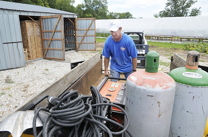
But, besides closed roads, Osage County's road and bridge department was dealing mostly with debris carried by floodwaters - and waiting to see if National Weather Service predictions of more rain would force the rivers to go higher.
There were no reports of injuries or major property damage along the Maries, Osage or Gasconade rivers.
The biggest flood threat appeared to be along the Gasconade, where the river's 34.4-foot crest Thursday afternoon at Rich Fountain set a new record - 1.1 feet deeper than the previous record set in 1982.
And a foot deeper than forecasters had predicted Wednesday evening.
The Weather Service didn't report a level at Mount Sterling, where U.S. 50 was closed at the bridge.
The recommended detour was U.S. 54 east from Jefferson City to Interstate 70 at Kingdom City, then to Missouri 19 and south through Hermann to Drake, to reconnect with U.S. 50.
U.S. 63 at Westphalia was reopened to traffic Thursday, after the Maries River flooding ended at that location. That river crested at 23.58 feet early Wednesday evening, 13.58 feet above the 10-foot flood stage. But it had dropped to under 6.1 feet by 4 p.m. Thursday.
Although the Maries still was high at its mouth with the Osage - at Mari-Osa-Delta - on Thursday morning, Osage County officials had no reports of problems caused by the high waters.
The Weather Service predicted some continued minor flooding along the Osage River at St. Thomas, which fell throughout the day Thursday after cresting at 25 feet - 2 feet above flood stage - Wednesday night.
The Cole County Sheriff's and Public Works departments reported no problems Thursday because of the flooding.
As both the Osage and Moreau rivers dropped throughout the day, roads and low-water crossings that had been closed because of high water were reopened.
Minor flooding also was forecast for the Missouri River at Chamois, where the river had reached the 17-foot flood stage Thursday afternoon, but was falling.
At Gasconade, the Missouri River reached 22.1 feet Thursday afternoon, and was expected to continue falling today.
At Hermann, the river was expected to crest at 23 feet this afternoon - 2 feet above flood stage - then slowly fall during the weekend, going below flood stage by Monday afternoon.
View August 2013 area flooding photo gallery
Online resources:
Lake operational data from Ameren Missouri
Area river and stream stages and forecasts