
The National Weather Service in St. Louis is warning Central Missouri residents to be on the lookout for possible flash flooding as heavy rain moves through over the next 24 hours.
Much of the area could receive 2-3 inches of rain by Thursday evening from a system that entered the area Wednesday, according to forecasters at the NWS office in St. Louis.
All rivers in the Jefferson City area were forecast to rise above flood stage.
The Missouri River in Jefferson City has been on the rise since Monday, when it was around 7 feet. It is forecast to reach over 28 feet by Saturday, 5 feet above flood stage of 23 feet. The forecast calls for it to fall below flood stage as soon as Sunday afternoon.
The Moreau River has gone up and down this week. The NWS now forecasts a sharp rise culminating Thursday evening, when the river is forecast to reach 28 feet, 11 feet over flood stage of 17 feet.
By Friday evening, forecasters believe the Moreau River will fall below flood stage.
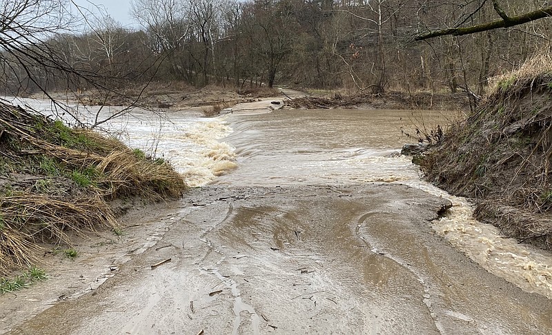
Since Monday, some roads along the Moreau River have been closed due to flooding.
As of Wednesday afternoon the Cole County Public Works Department still listed North Branch Road, Murphy's Ford Road and Vaughn Ford Road as closed. The county has low-water bridges or low-water crossings at these locations. These bridges and crossings are designed to handle normal or average rainfall, county officials said, but they will overtop during heavy rains.
The Osage River at the Mari-Osa Campground was expected to have moderate flooding, reaching 21.6 feet by Friday evening, 2.5 feet above flood stage of 19 feet. The river is forecast to go below flood stage by Sunday evening.
Additional resources: