
Editor's note: This is the first of a two-part series on the Woodcrest neighborhood.
Historian Julius Conrath, writing for "Ford's A History of Jefferson City" (1938), listed "Woodcrest, then Fairmount Place, succeeded by Forest Hill and Vista Place," as the "handsome additions laid out in the outskirts" following the final settlement of the state capital location in 1911. "All these additions," he added, "have been built up with beautiful and substantial residences surrounded by fine trees and handsome gardens."
Jefferson City had recently entered the 20th century. With the streetcars and automobile came mobility. Residents who were clustered near the city center for convenience to businesses and government gained freedom to move to city's outskirts away from the busy, crowded downtown.
Woodcrest was located just east of where Capital Region Medical Center is now. As with other new subdivisions located on the city's edges, Woodcrest was an upscale development becoming home to many of Jefferson City's elite.
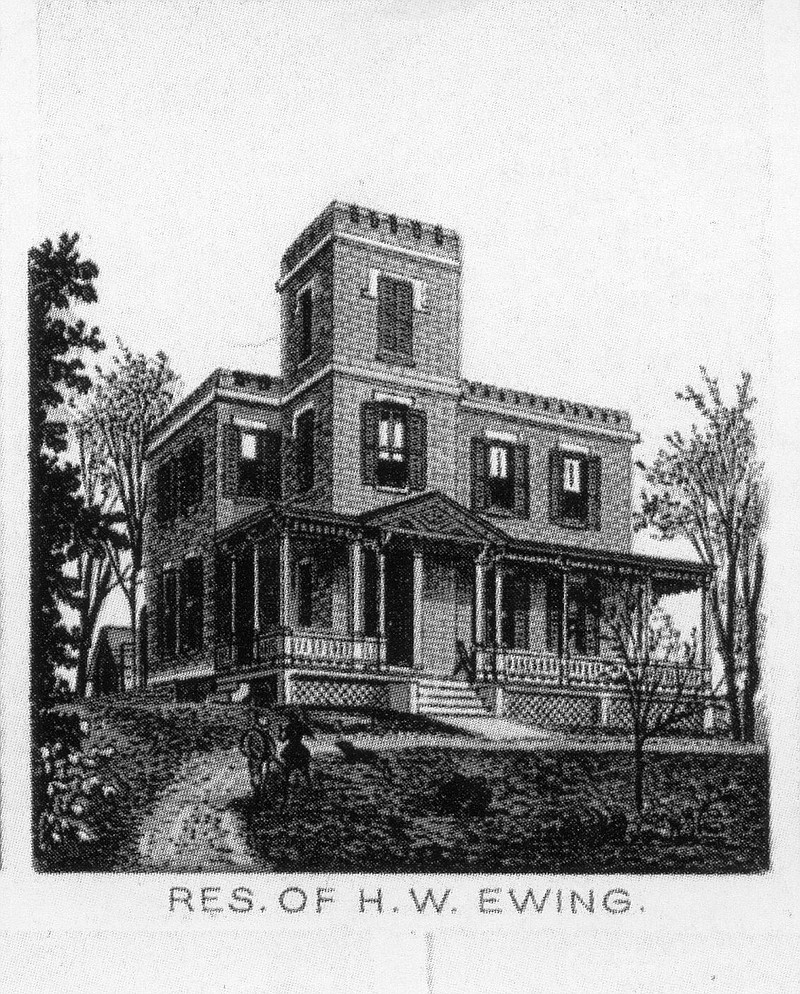
The term Woodcrest was used to describe this lofty city overlook long before the subdivision was platted in 1913. A sketch of one of the early grand homes in the area can be found in Suden's Souvenir of Jefferson City, Mo printed in 1891. Suden's book simply tells us the H.W. Ewing House was in "Woodcrest." Ewing bought the house in 1883, but it was built in 1869 for the H. Clay Ewing family (relationship unknown). H. Clay named the house "Schoenberg." Walter Schroeder noted in his book "Southside Sketches" that this term comes from the German word for "beautiful hill." Ewing had achieved great prominence in the community serving as a judge, mayor, bank president and attorney general.
Schroeder explained living up on a hilltop like Woodcrest was historically desirable as it was considered healthier. The miasma theory of disease persisted up into the 20th century. The breeze atop the hill carried away the "bad air" that caused disease. "Miasma" comes from the Greek word for "pollution." Other early suburban developments, like Fairmount Place and Forest Hill, were also situated up on wooded crests.
H. W. Ewing was president of the Tribune Printing Company and the son of Supreme Court Judge Ephraim Ewing. In his obituary, his nickname was "Farmer Ewing" because he lived on farmland in the outskirts. There were no street names yet in the area, but county records put the Ewing house on Monroe Street somewhere near the intersection of Woodlawn Avenue and Monroe Street. The southern city limits in 1900 ended around Atchison Street.
H. W. Ewing died in 1898, after which his widow, Mattie, moved with their four children to Kansas City. From the 1900 Illustrated Sketch Book, Ewing's biography reads, "His surviving widow, unwilling to endure her sorrow in the stately and hospitable home, 'Schoenberg,' in the south suburbs of the city, after the departure of the loved, and congenial companion, whose presence made it a place of joy, removed to Kansas City." By the time the streets around the house had names and showed up in the city directories, "Schoenberg" was history.
Schoenberg was gone, but the name lived on in the name of a real estate development company Schoenberg Land Company incorporated in 1905. The early investors were the "Who's Who" of central Missouri: G. A. Fischer, Charles Hough, Samuel B. Cook, Dorsey Shackleford and John A. Stewart, from Columbia. The company acquired a large tract of land in outlots 78, 79, 80 and 86 amounting to nearly 45 acres. In primarily the outlots of 78 and 79, they platted and filed the Woodcrest Addition in 1913. The area's historical name lived on in the name of the subdivision. Jefferson City High School now sets on outlot 80.
Originally, the school board had purchased land where Capital Region now sets for a new school, according to Schroeder. In 1919, Charles Hough responded by donating 1 acre of land at the corner of Hickory and Adams for a school playground. And 101 years later, Hickory Street Neighborhood playground is the city's oldest park.
The Woodcrest Plat included 113 lots on seven blocks bounded on the north by Tyler/Hickory streets, on the east by Jackson Street, on the south by Union Street and on the west by Monroe Street. They sold for about $600 each. Half of the lots were sold within a year. An ad in the 1924 Post Tribune touted: "Beautiful level lots in Woodcrest Addition. Shade trees, paved streets, side walks, water, sewers and gas mains." And the wider lots allowed for a driveway, something not found or needed prior to 1910 in the city's older neighborhoods. By 1930, the city announced it was extending its bus route to Woodcrest. In Schroeder's words, "urban sprawl begins in Jefferson City."
Part 2 next week will cover some of the prominent early residents of Woodcrest.
Deborah Goldammer and Jenny Smith are retired board members of the Historic City of Jefferson Inc.