
The latest surveying technology is being used to help the Missouri Department of Transportation (MoDOT) map eight projects around the state.
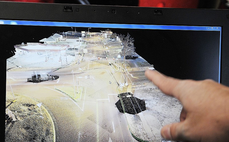
It's called LiDAR (Light Detection and Ranging), and it measures distance by illuminating a target with a laser and analyzing the reflected light to generate precise, three-dimensional information about the shape of the earth and its surface characteristics.
An aerial LiDAR scanner attached to a helicopter was recently used to do the mapping.
Two of the eight projects are located in Central Missouri. Bartlett & West of Jefferson City, along with Surveying and Mapping of Austin, Texas, have been working with MoDOT on these projects.
One is mapping Missouri 94 to look at where shoulder extensions could be done.
The other is for a bridge replacement on Route J in Camden County.
MoDOT officials said they've been using this technology over the last five years.
"This is a safety tool because this way we don't have to send out surveyors to do mapping in high traffic and potentially dangerous spots," said MoDOT engineer Alexa Mitchell. "It's not safe to have someone be out along places such as I-64 and I-44 in the St. Louis area so we have been using LiDAR in those areas."
Mitchell said this technology has also allowed them to extend their survey season.
"We still use photographers in planes to do surveys, but the LiDAR can penetrate through trees and vegetation so we can go longer than the normal January through March season," she said.