
Gov. Mike Parson said last week that the Missouri River basin states "need to speak with (a) unified voice" on managing the river.
In an editorial circulated Thursday to Missouri media outlets, Parson noted Congress authorized the U.S. Army Corps of Engineers to follow eight priorities in managing the Missouri, including flood control, river navigation, hydroelectric power, irrigation, water supply, water quality, recreation, and fish and wildlife (including preservation of endangered species).
"Congress authorized flood control and navigation as the dominant project purposes for the Missouri River system," Parson wrote. "However, during a 2004 update of the Master Manual, the Corps shifted the prioritization of these purposes to hold water higher in the reservoir system to benefit fisheries - an action that effectively reduced flood control."
During a 45-minute telephone conference call Friday with reporters and state and congressional officials, Corps' spokeswoman Eileen Williamson said: "We are aware of Gov. Parson's comments but have not yet had an opportunity to visit with him about his concerns."
Parson's comments came as water levels were rising in parts of Mid-Missouri, while people in Northwest Missouri, Southwest Iowa, Northeast Kansas and Eastern Nebraska - where flooding already has caused an estimated $3 billion in damage - were bracing for a second wave of higher water this weekend.
"We've had major devastation" in Northwest Missouri, state Sen. Tony Luetkemeyer, R-St. Joseph, told reporters at the Capitol last week. "We've had about 1,500 people evacuated along the river banks (and) numerous businesses that were forced to, at least temporarily, relocate.
"We need to make sure that we're getting the Corps focused on prioritizing people over fish and wildlife."
Sen. Dan Hegeman, R-Cosby, has introduced a resolution asking lawmakers to urge the Corps to "focus on the Corps' mandated responsibility to protect public health and safety through flood control (and) to continually place the utmost priority on flood control in any future modifications to the Missouri River Master Manual and in its annual planning with the goal of allowing the Army Corps to be able to successfully react and respond to unpredictable weather and extreme weather events so as to prevent future flooding disasters "
But, during Friday's conference call, John Remus - who is chief of the Corps' Missouri River Water Management Division - said the Corps operates the Missouri River as required by all eight Congressional mandates.
"It's the situation that guides what particular purpose" is most important at any given time, he explained. "Our operations decisions (now) are influenced most by the flood control purpose.
"For the last 12 months, our operational decisions have been guided by the potential for flooding."
Both Hegeman and Luetkemeyer pointed to last year's ruling by a Federal Claims Court judge - Senior Judge Nancy B. Firestone in Washington, D.C. - that agreed with about 400 plaintiffs who sued the federal government, claiming the Corps' river management policies favored wildlife protection over the farmers' and landowners' economic interests.
The Corps hasn't commented on the ruling, because the case still is active, while the court works to determine how much the government owes the affected landowners - if anything - for the damages caused by the changes in river management.
Parson's editorial and Hegeman's resolution both make the same claim as Judge Firestone's finding - the Corps changed its flood management plans in the Master Manual after 2004 in response to wildlife protection pressures and made flooding worse.
However, that ruling didn't find the Corps at fault for the severe flooding in 2011.
Still, Parson's editorial said: "After the 2011 flood, the governors of Iowa, Kansas, Missouri, Nebraska, North Dakota, South Dakota and Wyoming agreed that flood control was their number one priority. I am certain it remains so today."
That wasn't always the case.
Three decades ago, Montana and North and South Dakota were arguing the Corps placed too much emphasis on navigation and flood control, at the expense of recreational uses in their states, while the four lower basin states - Missouri, Kansas, Iowa and Nebraska - were making the same case they do today.
In a telephone interview Friday afternoon, Parson told the News Tribune he's confident the division among the states has changed in more recent years - and that, as he said in the editorial - the basin states' leaders "need to get together find our common ground and tell it to the Corps of Engineers."
In the editorial, the governor argued: "Despite Missouri's strong opposition, the Corps' recently released Missouri River Recovery Program Management Plan includes the possibility of an artificial spring rise, which would deliberately cause downstream flooding to purportedly benefit an endangered species of fish.
"As this year's flooding clearly shows, however, there are too many natural rises on the Missouri River.
"It is time for the Corps to finally abandon any proposal that includes a man-made spring rise on the Missouri River."
During Friday's conference call, no one mentioned any "artificial spring rise."
But, Remus said, the Corps is increasing the amount of water released from the Gavins Point Dam - which will increase the amount of water in the lower Missouri River - because one of the six mainstem reservoirs already is "in its exclusive flood control zone," and a second reservoir will be at that critical depth by the end of this week.
"This will create some space" in those reservoirs to handle the water run-off when the snow pack in the mountains starts to melt in April, he said - as well as for the significant snowmelt that already is happening in the Dakotas.
"The releases are necessary in order to reduce (greater) flood risk to the entire basin," Remus said.
Although the major flooding impact has so far been in Northwest Missouri, some Mid-Missouri farmers have had flooded fields - and this weekend still were trying to assess the damage.
The National Weather Service was predicting the Missouri and other area rivers would crest overnight Saturday or sometime today.
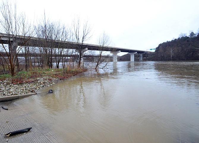
The Missouri at Jefferson City was predicted to top at 27.1 feet (4.1 feet over flood stage) before 6 a.m. today.
The river crested at Chamois on Saturday evening, at 23.2 feet (6.2 feet above flood stage).
And it also crested at Hermann on Saturday evening, at 27.91 feet (6.9 feet above flood stage).
The Osage River at Mari-Osa Access also crested Saturday, at 22.3 feet (3.2 feet above flood stage).
Only two roads in Mid-Missouri were reported closed Saturday evening - Missouri 179 in Moniteau County, which has been closed by high water since Tuesday - and Missouri 87 in Howard County, north of Boonville, which was closed last Monday.
Interstate 29 has been closed from north of St. Joseph into southwestern Iowa, for more than a week.
Buses instead of trains have been carrying Amtrak passengers between Kansas City and St. Louis - although MoDOT says on its website that trains should be running again on Monday.
And flooding along the Mississippi River also was beginning to close roads in eastern Missouri - from the Iowa border to near the Bootheel.
In his editorial, Parson wrote: "We must begin a serious discussion about how we improve flood control on the Missouri River.
"To accomplish this, the states of the Missouri River basin must reassert our leadership in guiding the federal government's management of the river."
Some information used in this story came from a Kansas City Star article.
Additional resources: