
Gov. Mike Parson on Friday authorized the state Natural Resources Department to waive or temporarily suspend any statutory or administrative rule or regulation "to best serve the interests of the public health and safety" during the current flooding emergency and recovery period.
Parson on March 21 declared a state of emergency because of the flooding along stretches of both the Missouri and Mississippi rivers.
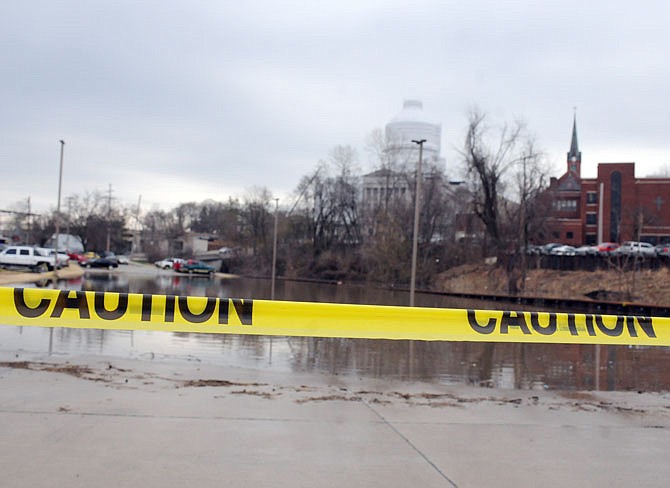
In a Friday afternoon telephone conference call with reporters, and state and congressional officials, the U.S. Army Corps of Engineers said flood waters in Mid-Missouri should crest this weekend.
The National Weather Service predicted a 26.6-foot crest at Jefferson City (3.6 feet above flood stage) about 5 a.m. Sunday, and a 22.9-foot crest at Chamois (5.9 feet above flood stage) about 5 p.m. Sunday.
Bob Gilbert, project managing engineer with the Bartlett and West engineering firm, told the News Tribune on Friday that 13 acres of Adrian's Island - including the area where a planned pedestrian bridge would connect the Missouri River land with the state Capitol grounds - remained above this week's flood levels.
"The predicted peak elevation of the river stays under that elevation by an inch or so," Gilbert said, "so this current flood is apparently close to the last flood in most people's memory - late December of 2015, which is how we determined the 13 acres that (have been) dry except for 22 days since the year 2000."
The Missouri also should crest at Hermann about 5 p.m. Sunday, the Weather Service said, at 27.6 feet (6.6 feet above flood stage).
The Weather Service said the Osage River at Mari-Osa Delta - just north of the U.S. 50-63 bridge - reached 21 feet (2 feet above flood stage) Friday morning, and was predicted to stay at that level through Wednesday.
And the Osage River at St. Thomas was at 8.43 feet at 5 p.m. Friday - 14.57 feet below flood stage.
Those Osage River levels shouldn't change, the Corps said Friday, because it has no plans to release water from Truman Lake at Warsaw until the river levels fall at Hermann.
Water releases from Truman Lake feed into the Lake of the Ozarks and, eventually, into the Osage River and the Missouri.
The Maries River at Westphalia was at 2.76 feet at 4 p.m. Friday - 7.24 feet below flood stage - but was expected to crest at 9.5 feet by 5 p.m. Saturday, a half-foot below flood stage, so some minor, lowland flooding is possible, the Weather Service said.
The Corps of Engineers operates six dams and reservoirs along the upper Missouri River, stretching from Gavins Point at the South Dakota-Nebraska border - the dam that is closest to Missouri - northward and westward to Montana.
Congress gave the Corps eight purposes for operating those reservoirs: flood control, river navigation, hydroelectric power, irrigation, water supply, water quality, recreation, and fish and wildlife (including preservation of endangered species).
During its Friday afternoon conference call, Corps officials said flood control was the most important criteria during times like these.
"Our goal is protecting life and safety," John Remus - who oversees the dams' operations - said.
In announcing the executive order allowing DNR Director Carol Comer to waive rules when she sees a need, Parson noted his March 21 emergency declaration was based on "worsening conditions along the Missouri and Mississippi River systems as a result of (water) release from upstream reservoirs, snow melt, and excessive rainfall."
The state of emergency declaration also activated the State Emergency Operations Plan, which allows state agencies to coordinate directly with local jurisdictions.
In his Friday afternoon news release, the governor said: "It's important that all state agencies continue to work together to help Missourians in flood impacted areas.
"We will continue to work closely with local, state and federal partners to monitor and ensure we are delivering resources Missourians need most."
The governor also asked the Missouri Farm Service Agency to assist in conducting agriculture damage assessments - which will be needed to ask for a federal disaster declaration for counties impacted by the historic flooding this month.
Those counties include Atchison, Andrew, Buchanan, Carroll, Chariton, Clay, Holt, Jackson, Lafayette, Platte, Ray and Saline, mainly along the Missouri River in Northwest Missouri.
However, Parson also asked the agency to use its discretion in assessing damage in Central Missouri - in Cole, Boone, Callaway, Cooper, Howard, Moniteau, Osage, Gasconade, Montgomery, Warren, St. Charles and Franklin counties along the Missouri River - as well as St. Louis City and County and several other counties along the Mississippi River in Eastern and Southeastern Missouri.
"Missouri agriculture is our state's number one economic driver, and we must do everything we can to ensure farmers and ranchers get the necessary help that is available," Parson said.
Nicole Roberts of the News Tribune staff contributed information used in this story.