
While the Missouri River's level and expected crests are going lower, officials with the U.S. Army Corps of Engineers in Kansas City were challenged Tuesday to find some means of providing relief to Missouri's river communities.
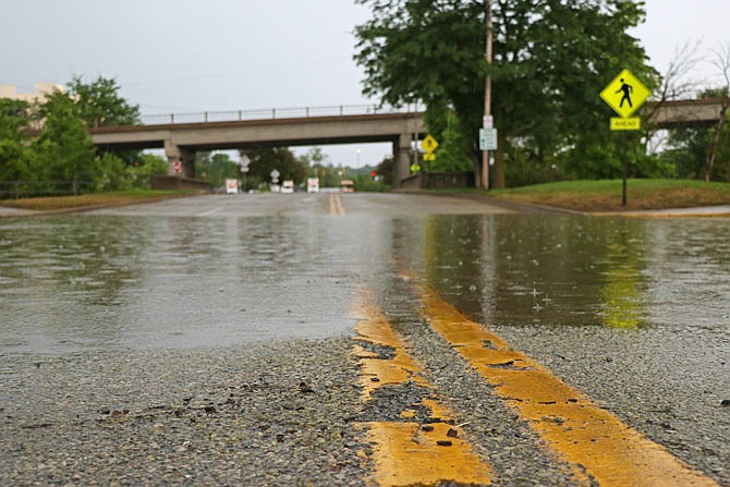
The forecasted crest for the Missouri River in Jefferson City was reduced to 29.5 feet Tuesday afternoon, according to the forecast from the National Weather Service in St. Louis. Following heavy rains that fell all along the Missouri River basin last week, the river had been predicted to reach as high as 31 feet or more in the Capital City.
But the river level Tuesday afternoon was 28.3 feet, and the crest is predicted to occur Friday afternoon with the river receding to 25 feet by Monday and getting below flood stage of 23 feet by July 4.
Although isolated storms were forecast on the Missouri and Osage basins, weather service officials said the seven-day forecast showed mostly dry conditions.
On the Osage River basin, the Corps reported Truman Dam at Warsaw was discharging 45,000 cubic feet per second Tuesday afternoon and was expected to stay at that level for the foreseeable future.
During a telephone briefing Tuesday, Corps officials said the mountain snow melt is nearly gone in the Dakotas on the northern end of the Missouri River, and the pools to contain floodwaters in the dams at the northern end were dropping slower than anticipated. With that said, Gavins Point Dam, the southern most dam, was reducing its releases Tuesday, from 75,000 cfs to 70,000 cfs, and the releases would stay at that level for the foreseeable future.
But some levee district managers in the St. Joseph area told Corps officials Tuesday they were in need of immediate relief and asked if the discharges from Gavins Point could be reduced much more than 70,000 cfs. The levee district managers said they can't get low enough levels to allow the river to drain by gravity, and they can't afford to keep up with the pumping needed to keep water out of vital infrastructure areas.
The St. Joseph contingent suggested a reduced discharge from the dam for eight to 10 days could allow areas downstream to naturally recede, and then the flood gates could be reopened.
But Corps officials said they have more than 11 million acre feet of floodwater stored in the upper dams and more will be added to that total. Even if no water was added to the existing pools, they said, 35,000 cfs of water would need to be evacuated to get flood pools to where they need to be.
The levee district managers suggested a quicker solution is needed.
"There's a tremendous amount of water these districts are dealing with, and levees that haven't failed probably still will thanks to water seeping into them from the inside," said Tom Waters, Missouri Levee and Drainage District Association chairman. "Whatever it takes, these folks need a break. You're engineers, smart guys. You've got to find a way to give these guys some relief. We know the process is slow, but we can't wait months. We need it in weeks."
Corps officials said they have started aerial reconnaissance of levees along the basin, many of which can't be reached because of flood waters not receding enough. They are prioritized with public safety being the number one factor followed by economic benefit to the community.
This is expected to be the largest levee rehab on the Missouri basin since the Flood of '93. Corps officials expect to get 100 requests for help and added some levees would no longer be able to provide the level of protection they had in the past.
Additional weather resources: