
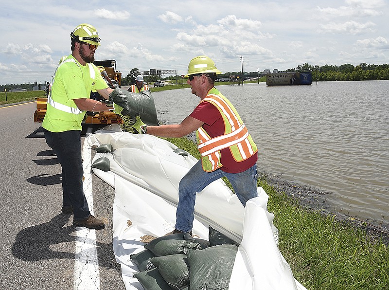
With the Missouri River creeping up two-tenths of a foot Wednesday morning, Missouri Department of Transportation crews began placing approximately 3,500 sandbags at two of the lowest points on U.S. 63 in an effort to keep potential floodwaters from reaching those areas.
The crews worked Wednesday afternoon and evening, and they planned to do more Thursday morning, MoDOT Central District Maintenance Engineer Jason Shafer said.
"We did work near the Katy Trail Bridge on 63 and on the southbound 63 ramp connecting to westbound U.S. 54 north of Jefferson City," Shafer said.
As of Wednesday evening, the river in Jefferson City was at 33.4 feet, but the National Weather Service forecast from St. Louis showed the river could start to recede as early as Thursday afternoon.
The sandbagging was a proactive measure and MoDOT didn't anticipate any further work, Shafer said, but that could change if heavy rains fall in the area.
"The water is getting close to these low spots, and we want to keep the water off the road as long as possible," Shafer said.
Based on historical listings from the National Weather Service, it would take a river level of 34.1 feet for water to flow onto U.S. 54/63, Shafer said.
"We've done some surveying of our own, and our roads are a little above that height," Shafer said. "After the Flood of '93, MoDOT did raise the southbound lanes of 63.