
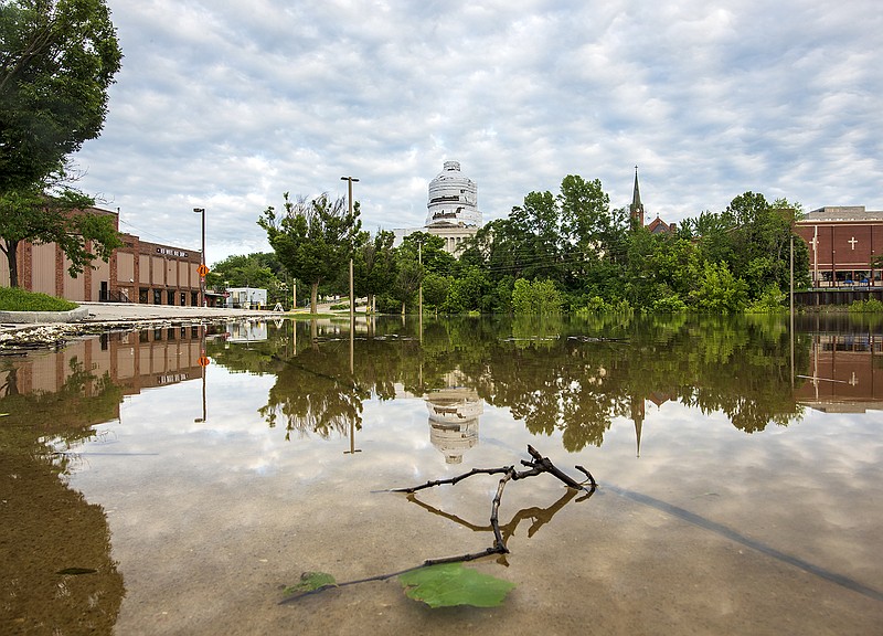
Since the start of last week, the Missouri River in Jefferson City has dropped and rose just slightly, staying between 32.5-32.9 feet, nearly 10 feet above the 23-foot flood stage.
As of Saturday afternoon, the forecast from the National Weather Service in St. Louis did not indicate any change from that pattern until late this coming week, and that was dependent on how much rain would fall in the region the next few days.
The forecast for the week showed today and Monday to be dry, but there's a chance of rain each day the rest of the week through next weekend.
Saturday morning, the U.S. Army Corps of Engineers announced they had increased their flow out of Gavins Point Dam in South Dakota, the southern-most dam on the Missouri River, from 70,000 cubic feet of water per second (cfs) to 75,000 cfs.
During a media conference call Saturday, corps officials said recent heavy rains on the northern end of the river meant they had to increase the discharge to get the pools at the northern dams back to levels to where they can start storing more water.
Corps officials also announced, through the weekend, they were keeping releases at Truman Dam in Warsaw on the Osage River at 30,000 cfs, but they could increase to as high as 70,000 cfs over this coming week if the forecast allows. As of Saturday afternoon, Truman was half of a foot below full flood capacity. Corps officials also said they look at the Missouri River level in Hermann to guide them in their releases.
As of Saturday afternoon, the river was at 32 feet in Hermann and expected to crest about a half foot higher by Monday before it began to go down. The flood stage at Hermann is 21 feet.
Downstream on the Osage, at Bagnell Dam at Lake of the Ozarks, Ameren Missouri officials said Saturday afternoon they had not opened the flood gates, but were monitoring what was taking place at Truman so they could balance the water levels as best as possible.
Also during Saturday's media call, Corps officials said two Mid-Missouri levees - the Reveaux, an agriculture levee downstream of Jefferson City on the left descending bank of the Missouri River, and the Wainwright, an agriculture levee downstream of Jefferson City on the left descending bank of the Missouri - had both been overtopped. The entire levee system on the lower Missouri was described by one official as "tenuous at best," and more breaches and overtoppings were expected in the next couple of days.
Flood conditions locally have led to ongoing road closures.
Knowing what the latest forecasts were predicting, Jefferson City Public Works officials said, for the foreseeable future, the only east/west routes open through Jefferson City's downtown area will remain High Street and U.S. 50.
Those who travel from east of Jefferson City to work in the downtown area are being asked to take the Lafayette Street exit and take city streets to get to their destination, with the hope of easing traffic on U.S. 50.
Jefferson City's website lists the latest information on flooding and tornado recovery, city officials noted. A link on the website's homepage shows flood maps updated with street closings.
The Cole County Public Works Department listed just six roads closed in the county. All were in either Osage City or along or near the Osage River. These included Engineers Road, Railroad Street, Water Street, Lock and Dam Road, Lisletown Road and East Cole Junction.
The Missouri Department of Transportation travelers map showed hundreds of roads closed due to flooding, primarily in northern Missouri and all along the eastern border of the state where the Mississippi River is flooding. In Central Missouri, the flooded roads included all of Northern Jefferson City such as Route W, Cedar City Drive, Outer Road 63 and Missouri 94. Missouri 179 is also closed in several locations in Cole and Moniteau counties because of flooding from the Missouri. To see all the state road closings check the link below.
Weather resources:
Ameren's Truman and Bagnall Dam daily report
Missouri state highway road closings