
Weather officials said Monday two things have led to flooding along area rivers and streams: already saturated ground, and a lack of vegetation, so the ground can't absorb rainfall.
"Had this been snow, the county would have been paralyzed," Cole County Public Works Director Larry Benz said Monday. "I had over seven inches of rain at my home - so, if you think about it, if the temperatures had been a little colder, we could have had a couple of feet of snow, or maybe more.
"There's no way we could keep up with that."
Cole County roads affected by flooding are along the Osage and Moreau rivers.
Benz said the good news is, once the rain moves out, most of the roads open up quickly.
"I know that there will be people who will have to deal with water in buildings after this, but it could have been a lot worse," Benz said.
Public works crews have been out since the heavy rains started this weekend and other than gravel washing out in some areas, they have not seen any major damage to roads caused by flooding.
"I don't believe there have been any calls received due to water in buildings from flooding, although sometimes there is a lag on getting called by property owners," Don Fontana, Jefferson City's stormwater engineer and floodplain administrator, told the News Tribune Monday.
"I'm sure we will be getting a few calls at some point."
City officials already were getting calls about stormwater problems, such as settlement in yards over pipes, brush and debris in channels, Fontana said, "and we had a call about a large tree falling over on city right of way."
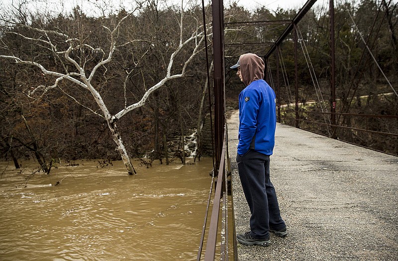
Wears Creek was "definitely full, as are all the other creeks in town," he added, with some flooding reported on nearby parking lots.
One city street was under water. Green Meadow Drive was under more than three feet of water, at the entrance to the River's Edge Estates, due to flooding on the Moreau River.
Fontana said the Moreau is approaching the record crest depth at the nearest upstream gauge at Tanner Bridge Road. Flood stage there is 17 feet, "and at 1:30 p.m. (Monday), the gauge was at 33.24 feet. If we don't get any more rain, it should crest pretty quickly - and then it usually goes down fairly quickly," he noted.
At 13 recording sites maintained by the U.S. Geological Survey (USGS), officials said they've never had readings as high as they are seeing now on the rivers and streams they check on.
Since Friday, when heavy rainfall began to cause widespread flash flooding, the USGS office in Rolla has had field crews out measuring flooding across southwestern and southern Missouri and northeast into the St. Louis area.
Six crews are measuring high flood flows and verifying streamgauge operations on the Arkansas, White, Gasconade, and Meramec River valleys.
Paul Rydlund has worked 22 years for the USGS and said with all the flooding, they can't always drive to the gauges that need to be checked - so they have had to use boats to get to many of the sites.
"We have 265 streamgauges we are charged with checking that measure water levels, streamflow and rainfall," he said. "For 15 people, that's a lot of work."
Rydlund said the USGS is collecting critical streamflow data that is vital for protection of life, property and the environment. This data is used by the National Weather Service to develop flood forecasts, the U.S. Army Corps of Engineers to manage flood control and local agencies in their flood response activities.
"The information we collect can help the weather service project days out what will be impacted, what roads will be closed or structure could be affected," he said. "We need to be out on the fly to get the information. The gauges are also important for river navigation and bridge designing, making sure they handle a 100-year flood. The gauge information also helps in the design of levees for flood protection. We need to be out there on the fly getting this information."
Rydlund said they'll continue to take these non-routine measurements as long as creeks and rivers are up.
"When they go down we'll taper off," he said. "Our routine is to do measurements every six to eight weeks. That's because bank and channel bottoms change and that can affect measurements.
"Just like when floods occur and we do high flow measurements, we also go out during drought conditions so we know about water availability."
3 Callaway roads closed by flooding
The Missouri Department of Transportation closed three roadways Monday morning in Callaway County due to major flooding and dangerous conditions.
State Route 94 was closed Monday morning because of water covering the roadway, according to MoDOT's flooded road closures report early Monday evening. The flooding on westbound lanes began 1.4 miles before Routes PP and W and ended 5.06 miles after Routes D and N, the report said.
The flooding on eastbound lanes of Route 94 began .27 miles after Routes D and N and ended .04 miles before Routes C and S. Route C heading southbound was also closed late Monday morning with flooding reported to start .18 miles before state Route 94 west, ending less than .01 miles before state Route 94 west.
Lt. Clay Chism with the Callaway County Sheriff's Office advised drivers to not attempt to drive through flooded areas, as most low-water crossings are impassible, along with low-lying areas that usually flood.