
The National Weather Service has issued a flash flood watch for Mid-Missouri, including Cole County and Jefferson City.
The watch is in effect through Thursday afternoon. It covers various counties, including Cole, Callaway, Boone, Gasconade, Osage and Moniteau.
A flash flood watch means that flash flooding is possible but not imminent in the watch area. People in the watch area should be aware of the possibility of heavy rainfall and flash flooding.
Several rounds of thunderstorms could bring an additional 1 to 3 inches of rain to parts of Missouri and Illinois during the watch period. The National Weather Service also said heavy rainfall would result in flooding in low-lying areas or poor drainage areas.
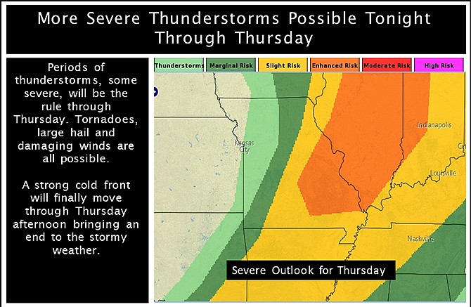
The weather service predicts an 80 percent chance of thunderstorms tonight, followed by a 70 percent chance tomorrow.
Severe thunderstorms making their way across Missouri are packing 70 mph winds and several are capable of producing tornadoes.
Weather spotters reported a funnel cloud at 3:35 p.m. Wednesday near Potosi in eastern Missouri, while an hour earlier the Bates County emergency manager reported an EF-0 tornado in southwest Missouri that destroyed a 60-foot machine shop.
Several eastern Missouri counties were placed under tornado warnings as storms moved through. Officials in Washington and St. Francois counties have received reports of flooding, along with downed trees and power lines. Part of a room was blown off a building west of Potosi, but no one was hurt.
Meanwhile a band of intense thunderstorms was moving into the western part of the state from southwest Kansas, bringing reports of high winds and ping pong ball-size hail.
Additional information: