
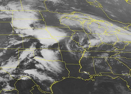
All of Mid-Missouri is under a tornado watch until 10 p.m. today, the National Weather Service said this afternoon.
The NWS Storm Prediction Center in Norman, Okla., said weather and climate conditions "are favorable" for the possible formation of tornadoes or severe thunderstorms in, and close to, the watch area - which includes northern Missouri, southern Iowa, northeastern Kansas and the far-southeast corner of Nebraska.
The center's watch reminds Midwesterners that a "watch" doesn't mean a storm or tornado has been seen - just that it's possible for one to form.
"The primary threats include several tornadoes possible," the NWS report said, in addition to "several very large hail events, to 3 inches in diameter, and possible damaging wind gusts up to 70 miles per hour."
Residents are urged to keep monitoring radio broadcasts, in case a warning is issued either for a tornado or for a severe thunderstorm.
The weather service noted there is a "potential" for "intense (storm) supercells capable of very large hail and damaging winds."
People "should be on the lookout for threatening weather conditions," the weather service said.