
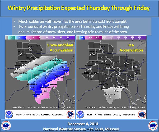
The forecast Wednesday night indicates a strong cold front will continue to move southeastward through Mid-Missouri. Much colder air will move into the region behind this front.
The National Weather Service reports two upper level disturbances will move across the area which will produce wintry precipitation on Thursday and Friday.
The one on Thursday will produce a mix of freezing rain, sleet, and snow over parts of the area; while the one on Friday will produce primarily produce snow. This will be the first accumulation of snow and ice over much of the area during this winter season.
In addition, there is a chance of wintry precipitation on Sunday as well. Well below normal temperatures are expected through the weekend as an arctic high settles over the Great Lakes. Temperatures will be 20 to 25 degrees below seasonal normals.
Forecast maps Wednesday night indicated measurable snowfall will generally be along, south and east of U.S. 54, with heavier amounts in southern and east central Missouri.
View video weather report here if it fails to load automatically.
Additional resources:
Detailed weather forecast, radar, advisories