
Snow is expected to continue across central Missouri overnight with accumulations building into Tuesday morning.
The National Weather Service (NWS) reports snow could be moderate to heavy at times on Monday night and early Tuesday, before ending from west to east. Most locations will see between three and six inches of snow, with locally higher amounts possible across northeast and central Missouri.
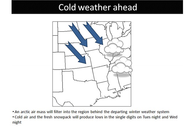
Bitterly cold temperatures won't be far behind, with lows forecast at only 4 degrees on Tuesday night and Wednesday night.
From the NWS, a Winter Weather Advisory, effective until noon Tuesday, states:
- TIMING...SNOW WILL CONTINUE THROUGH TUESDAY MORNING. THE SNOW WILL BE MODERATE TO HEAVY AT TIMES TONIGHT CAUSING VISIBILITIES TO FALL TO 1/2 MILE OR LESS.
- ACCUMULATIONS...TOTAL SNOW ACCUMULATION OF AROUND 3 TO 6 INCHES OF SNOW IS EXPECTED WITH LOCALLY HIGHER AMOUNTS POSSIBLE.
- IMPACTS...COLD GROUND TEMPERATURES WILL LEAD TO QUICK SNOW ACCUMULATION. ROADS...ESPECIALLY LESS TRAVELED OR UNTREATED ROADS...WILL BECOME SNOW COVERED AND HAZARDOUS.
PRECAUTIONARY/PREPAREDNESS ACTIONS...
A WINTER WEATHER ADVISORY IS ISSUED FOR A VARIETY OF WINTER WEATHER CONDITIONS...SUCH AS SNOW...BLOWING SNOW...SLEET...OR FREEZING DRIZZLE AND RAIN. IT ONLY TAKES A SMALL AMOUNT OF WINTRY PRECIPITATION TO MAKE ROADS...BRIDGES...SIDEWALKS...AND PARKING LOTS ICY AND DANGEROUS. IT IS OFTEN DIFFICULT TO TELL WHEN ICE BEGINS TO FORM...SO DO NOT BE CAUGHT OFF GUARD.
Resources:
Local Forecast, Current Conditions
Area Radar, Severe Weather Statements